FOUNDED ON GEOLOGY
+44 (0)1462 743 005
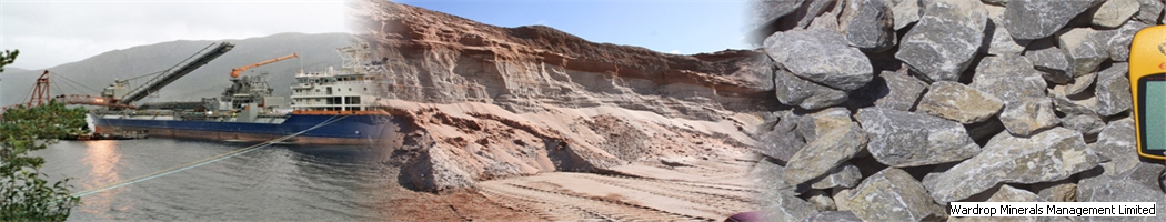


Consultancy and Services for the Dry Bulk Minerals Sector


It is a simple truism that minerals can only be worked where they lie, and quarries for sand and gravel or for crushed rock need landsearch activity to identify mineral bearing land for greenfield developments or extensions to existing quarries. Mineral companies only survive in the long term if they identify, explore, secure, and gain planning permission on new mineral assets to replace those that they sell. Over the author's 40 years in the construction material quarrying industry there have been significant changes in land search practice and the use of different tools to do the job.
Replenishment of reserves is something that a prudent company keeps an eye on and invests in. For long term survival reserves sold must be replaced by an equal or greater volume of reserves gaining planning consent. Nationally in the UK replenishment rates as tracked by the Mineral Products Association have been dropping for some years for both sand and gravel and crushed rock.
There is a fairly well established process to locating workable mineral resources:-
In the author's former companies most of these steps were the responsibility of the geology and mineral exploration department. In some companies the initial market work and contacting landowners might fall to Estates Managers as might the subsequent acquisition and planning phases. Smaller companies may outsource the exploration project to a consultant geologist or multi-disciplinary planning and geological consultancy. In any event the overall process is a team effort although the exploration, assessment and determination of mineral resources must always be lead by geologists.
The principles set out here are developed from working in countries with a well established national geological survey, or good university sources of geological information, and a formal town and country planning process. The general order of activity however works equally well in jurisdictions with less publicly available information.
In some areas, especially where several quarries already operate, the mineral potential may be well known and the geologist can go straight to the exploration drilling and assessment stage on land close to existing operations. However in many other areas, and over the last few decades as the 'easy' sand and gravel has been worked the geologist must undertake an organised process of landsearch in order to target exploration for hidden resources. The generic term for this process is 'sieve mapping'.
The basic principles of sieve mapping are the same now as they always have been but the tools available and the application of them has changed. The principle is to start with geology and overlay constraints to development. Also consider factors such as access to transport links and landscape on the ground. Availability of water is now a material consideration in some parts of the UK and a definite constraint in water stressed catchments.
In an ideal world some prospect sites will come through the sieve with no or few constraints.
Constraints can be statutory, environmental, practical and legislative, and/or self determined such as market areas or company preference. Statutory constraints exist at various levels from European Directives to local authority designations. Some are negotiable or can be mitigated whereas some of the higher level ones are showstoppers. The author groups into 4 levels (in the UK) as follows:
The status, age and style of any extant or developing Mineral Local Plan is an important influence on the landsearch process. A good MLP will have done some of the early 'sieving' steps already and may have credible geology based areas of search. A site specific Plan may be of less direct use since most potential sites in a published plan will have already been secured by a mineral operator.
If an MLP is old, coming up for review (usually on a 5 year timescale), or covers a County with a very large landbank, you may in reality be looking for sites on a longer timeframe to put forward for the next Plan.
Having shortlisted the prospects the next step is to determine land ownership and mineral ownership, and ideally try to secure the prospect for a period of time by a legal Option.
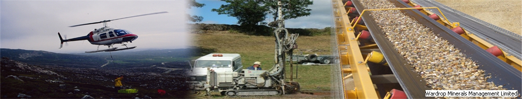
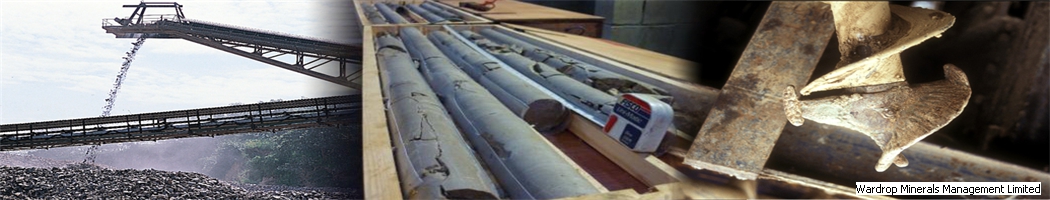
Geologists (in-house or consultant) will design and arrange an exploration programme using an appropriate mix of geophysical techniques, borehole drilling and laboratory testing. If viable mineral resources are discovered of suitable quality and quantity then a reasonably accurate notional mineral reserve will be derived by designing a notional quarry, excavation or surface mine. This furnishes the basic information for a negotiation to start on acquiring the mineral by freehold purchase or lease.
In the old days, i.e. Pre Windows 95 "computer on every desk" this constraint mapping was a physical process on paper. The geological map could be the physical base map or alternatively the solid or superficial geology could be transcribed onto another base map. The author's employer started with a single geology map and ended with an impressive archive of maps covering all of the UK, Norway, many parts of France, Spain, several key areas of USA and Middle East, and some Eastern European countries. This took up a considerable amount of office space and has been replaced almost entirely by digital mapping.
Constraints would be drafted on transparent film and physically overlain on the base map. Areas of land might come through with no constraints or an acceptable number of modest ones.
Now this preparation is easily done on GIS - Geographic Information Systems - with a digital geology background and constraint datasets that are freely available in many countries.
Despite technology taking the legwork out of initial landsearch phases it is still an absolute requirement to look at a prospect and surrounding setting on the ground. Owners and occupiers still have to be approached carefully and courteously, still need the human skills with negotiation and influencing along the road to a planning application.
In the field it is necessary to look at prospects in context. The geologist or land search manager will look at the landscape, road network, get a feel for what the competitor companies are doing, see how a prospect site sits alongside its neighbours - is it overlooked, is there a good cover of woodland, hedges or copses that can provide natural screening. The intangibles are important too - now nice is area and how does it feel - does it seem suitable for hosting an industrial operation. Professional judgement is required.
Before the digital revolution one would frequently have to knock on doors like an old fashioned door to door salesman in order to check land ownership. This always required you to have your wits about you ready to respond to the first few seconds of conversation. If for instance a farmer is aggressive, or is a tenant, or is farming land already owned by competitor, you don't want to declare initially who you are or which company you represent and you might have to extricate yourself from the conversation.
Online Land Registry and Electoral Roll makes it much easier and less error prone to find out ownership and occupancy. An owner/occupier can be approached by a courteous letter or email with a follow up visit after an appropriate length of time.
Landsearch takes place very early in the long term and complex lifecycle of mine or quarry development - sometimes a decade or more before an operating site comes to fruition - and therefore as an activity it tends to have a very low profile and is often not appreciated as it should be. Land search, exploration and negotiation must be highly confidential even within companies and the professionals undertaking it can also suffer from a low profile especially amongst those who have a shorter term day to day responsibility for profit generation. The roles are not seen as dynamic (or even as necessary by some) but in fact are highly skilled, require great tenacity, professionalism and negotiating skills, and ultimately provide the basis for survival of asset based companies. No mineral, no business.
Geologists or other explorationists are usually the first point of contact between the company and a landowner/occupier and they can make or break what has to become a trust-based relationship. The exploration borehole drilling exercise will usually be the landowner's first opportunity to see the company in action and the degree of professionalism demonstrated such as care for growing crops, livestock, response to ground conditions and weather will heavily influence the perception of how a company actually performs.
Every profession has its' own jargon and companies develop their own language.
Land search can be exploration; mineral search; resources search; new mineral; reserves or resources assessment; prospect search; site search; site appraisal; replenishment; greenfielding; greenfield search; greenfield site development; sieve mapping.
Mineral can include sand and gravel; hard rock; crushed rock; limestone; cement stone; gypsum; sand; silica sand; industrial sand; brick and ceramic clay; ballast; PSV; Chalk; magnesian limestone; building stone.
Mineral Local Plan can be Mineral Plan; Minerals and Waste Plan; Minerals and Waste Local Plan; Minerals Local Development Plan; Areas of Search.
Drilling can be sounding; boring; borehole drilling; coring; ground investigation; site investigation; probing; trial pits; mineral resource assessment.
Quarry can include site; pit; extraction site; excavation; surface mine; working; quarry extension.
Replenishment might include planning permission; permitted reserves; consented reserves; planning consent; proven resources; proven reserves.
Duncan Wardrop
Wardrop Minerals Management
October 2019
I sit on two of the Mineral Products Association committees and therefore try to speak for a wider constituency than just the aggregates industry. The minerals I refer to are the solid, non energy, industrial minerals.
Read more about - Supply Chain Resilience and the Environment...
The importance of water to the minerals industry, the ambitions of Lafarge to achieve full water footprinting, and the contribution that good science will be needed to make in the future.
Read more about - The Importance of Water to the Minerals Industry in Britain...
Coastal gravel quarry in a Scottish raise bed, A limestone quarry in Staffordshire, A gritstone quarry in South Wales and many more.
Read more about - A Few Quarry Problems Solved...
For many years, since minerals planning was formalised through a Minerals Local Plan based system in the early 1980s, County Councils as mineral planning authorities have carried a general responsibility to try and avoid mineral resources - mainly bulk materials such as aggregates and clays - from being sterilised, or put beyond use, by permanent surface development.
In the author's experience this responsibility was discharged fairly patchily in the distant past but following the introduction of the National Planning Policy Framework (NPPF) in 2012 many Counties are applying sterilisation policies with greater vigour.
Read more about - Minerals Sterilisation considerations for Land Developers...
The author's former company in the early 1980s purchased and began to develop a High Polished Stone Value (PSV) quarry in South Wales. The geological sequence was the Carboniferous Pennant Sandstone and altogether about 160 metres vertical thickness of this deposit was to be intercepted by the quarry working.
Prior to purchasing the operation a core drilling exercise was carried out involving drilling through the full relevant sequence.
Read more about - Frequency Analysis of Clays in a Sedimentary Sandstone Sequence...
The UK Government is aware of risks that are posed by extreme weather events to infrastructure such as roads, railways, power and communications systems, and consultations have taken place with various industrial sectors. The minerals industry as represented by producers of solid, non-energy, industrial minerals and construction materials has a voice in that consultation.
Read more about - Supply Chain Risks due to Extreme Weather Events...
Minister, Ladies and Gentlemen:
It is a privilege to be able to respond on behalf of the Mineral Industry Research Organisation to DEFRA's Review of the Sustainability Fund Research Projects. MIRO and English Heritage have selected a most interesting venue for this launch and The Wellington Arch is perhaps slightly more relevant than many people might at first think.
If you would like further information then please contact us on +44 (0)1462 743 005, email us at info@wmml.co.uk or fill in our contact form and we will be in touch as soon as possible.
FOUNDED ON GEOLOGY
+44 (0)1462 743 005
Consultancy and Services for the Dry Bulk Minerals Sector
Contact Wardrop Minerals Management Limited
t: +44 (0)1462 743 005
e: info@wmml.co.uk
Baldock, UK


OK
Yes
No